
Artec Twins

Artec Twins

Software for processing, visualizing and analyzing digital twins of massive environments, from city-scale maps to engineering-grade detail

Artec Twins brings satellite, drone, 3D scan and photo data together into one interactive digital twin, so you can explore, measure and analyze environments of up to 100 km² in real time.

  • Real-time rendering at up to 200 FPS
  • Environments of up to 100 km²
  • Gaussian splatting from photos, video, point clouds or meshes
  • Point clouds, meshes and splats in one workspace
  • Distance mapping, cross-sections and volume calculation
  • Georeferencing with ground control point support

Categories: , Brand:

Free Trial and exclusive promos with registration

Free Demo with instant booking and a special offer for participation

Artec Twins: Digital Twins of Massive Environments

Artec Twins is Artec 3D’s software for processing, visualizing and analyzing the largest 3D datasets. It brings satellite imagery, drone captures, 3D scans and photos or video into one interactive digital twin, from a whole city down to a single component. Explore scenes of up to 100 km² in real time, generate lifelike Gaussian splats, and measure, compare and export your results in industry-standard formats.
Capture Reality With Any Technology

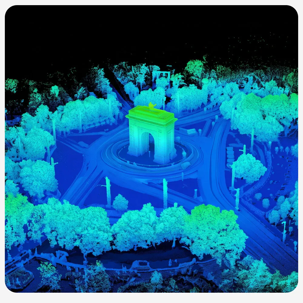
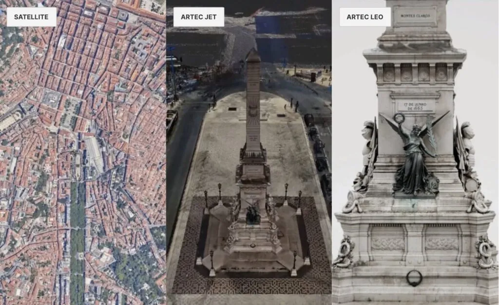
Artec Twins works with the data you already have. Map the surrounding area for context with satellite imagery, capture large sites and structures from the air with a drone, pick up fine details with sub-millimeter 3D scanning, and turn ordinary photos or video into photogrammetry models. Then combine them into one complete digital twin: city-scale mapping from satellite or drone data, landmarks, bridges and buildings digitized with LiDAR scanners such as Artec Jet, and individual objects in the scene captured with engineering-grade accuracy using scanners such as Artec Leo.

One location captured three ways in Artec Twins: satellite imagery, an Artec Jet LiDAR scan of a city square, and an Artec Leo scan of a monument

Render and Navigate Massive Datasets in Real Time

Explore interactive digital twins without lag, without decimation and without leaving details behind. Artec Twins renders at up to 200 FPS, turns environments of up to 100 km² into accurate digital twins, and handles billions of data points with dedicated tools. Trajectory display shows your full capture path so you can verify coverage and plan your route, and first-person view lets you explore your data from the inside, at fixed viewpoints or moving freely. Data overlays switch between height, color, normals and intensity, and 360° panoramic texturing adds color and visual context to Artec Jet and Ray II scans.

Point Clouds, Meshes and Gaussian Splats in One Workspace

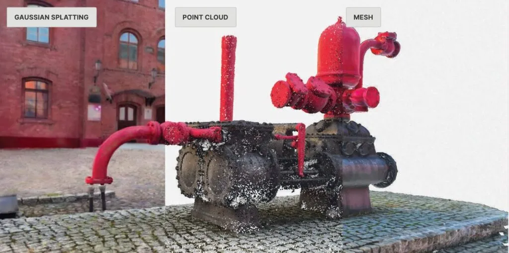
Switch between visualization and engineering, and use the format that best fits the job. Artec Twins includes an all-new Gaussian splatting algorithm for reconstructing lifelike scenes. Generate splats from photos and video, point clouds or 3D meshes, or import, export and render splats you already have. It reconstructs tricky surfaces, including dark and shiny ones, and can create splats from LiDAR data so lifelike visuals come with geometric accuracy.

The same industrial pump shown as a Gaussian splat, a point cloud and a mesh in one Artec Twins workspace

Working at scale? See what Artec Twins can do with your data.

Talk to our team about Artec Twins and how it fits with the Artec Jet, Ray II and Leo scanners you already use or are considering.

Why Choose Artec Twins?

1

One Digital Twin From Every Data Source

Combine satellite, drone, LiDAR, 3D scan and photo data in a single scene, so the wide view and the fine detail live in the same model.

2

Lifelike Gaussian Splatting

Reconstruct realistic scenes from photos, video, point clouds or meshes, including the dark and shiny surfaces that are hard to capture any other way.

3

Measurement You Can Act On

Fit CAD primitives, map deviations, cut cross-sections and calculate volumes, with georeferencing that keeps every measurement where it belongs in the real world.

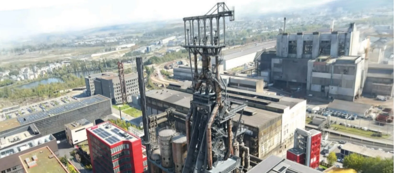
Aerial Gaussian splat of an industrial site with a blast furnace, reconstructed in Artec Twins

Built-In Analysis Tools for Actionable Insights

Artec Twins turns captured data into measurable results. Measure inside your point cloud, validate, compare and export in industry-standard formats.

  • CAD primitive fitting: fit spheres, cylinders and planes to assess flatness, check geometry and extract dimensions.
  • Distance mapping: compare point clouds, Gaussian splats, CAD models or meshes to find deviations, validate tolerances and monitor change.
  • Georeferenced accuracy: ground control point support and built-in georeferencing.
  • Profiles and cross-sections: evaluate gradients, verify clearances and isolate structures for analysis.
  • Scan-to-CAD comparison: overlay point clouds and meshes on CAD models to see where reality differs from design.
  • Volume calculation: quantify material, track change over time and plan with confidence.
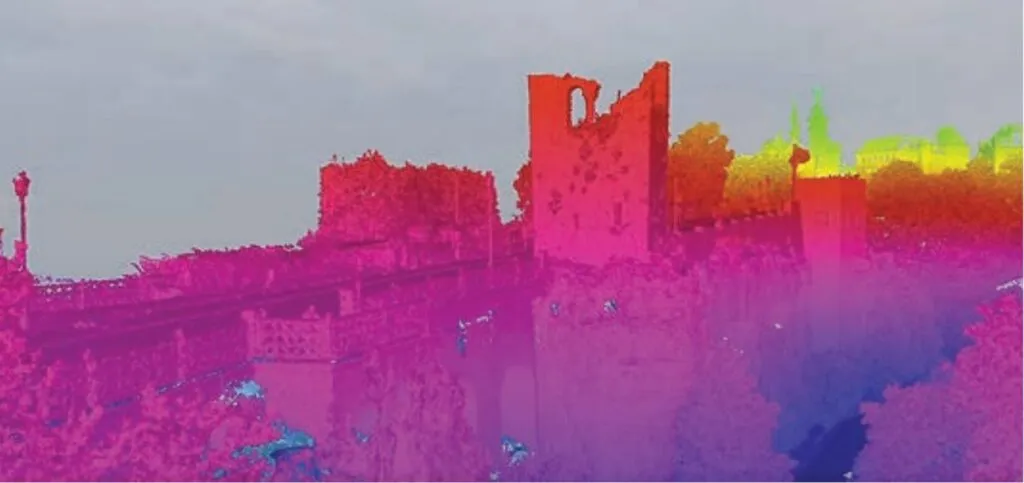
Point cloud of a historic castle wall with a height color overlay in Artec Twins

From a single landmark to an entire city, build digital twins with no detail left behind.

Contact Digitize Designs to learn more about Artec Twins and get it set up for your projects.

Frequently Asked Questions

Artec Twins is software from Artec 3D for processing, visualizing and analyzing digital twins of large environments. It combines satellite, drone, 3D scanning and photo or video data into one interactive scene that you can explore, measure and analyze.

Satellite imagery, drone captures, 3D scans and photos or video for photogrammetry. That includes LiDAR data from scanners such as Artec Jet and Ray II and detailed object scans from scanners such as Artec Leo. Point clouds, meshes and Gaussian splats can all be used in the same workspace.

Artec Twins is built for environments of up to 100 km² and datasets of billions of data points, rendered at up to 200 FPS for smooth real-time navigation.

Yes. Artec Twins can generate Gaussian splats from photos and video, point clouds or 3D meshes, and it can import, export and render splats you already have. Splats created from LiDAR data pair lifelike visuals with geometric accuracy.

Architecture, engineering and construction (AEC), surveying and geospatial, mining, defense, infrastructure, public safety, heritage preservation, and oil and gas.

Contact our team for pricing and licensing, or to talk through how Artec Twins fits your workflow and the scanners you use.

Talk to a 3D scanning engineer

Choose whatever is easiest for you: give us a call, book a Zoom call, or send us a question.

Web form · to an engineer

Send us a question

Tell us about your parts and what you need from a scanner. An engineer will get back to you by email.

Prefer to talk now?
+1 864-469-0093

Zoom · with an engineer

Schedule a Zoom call

Pick a day and time that suits you. The Zoom link comes by email as soon as you book.

  • Talk with one of our certified engineers
  • See the scanner in action and ask your questions
  • Free, with no obligation
Prefer to talk now?+1 864-469-0093
Loading available times…