How to Build a First Article Inspection (FAI) Workflow with 3D Scanning
A first article inspection is where a new part program proves it can actually make the drawing. For aerospace and
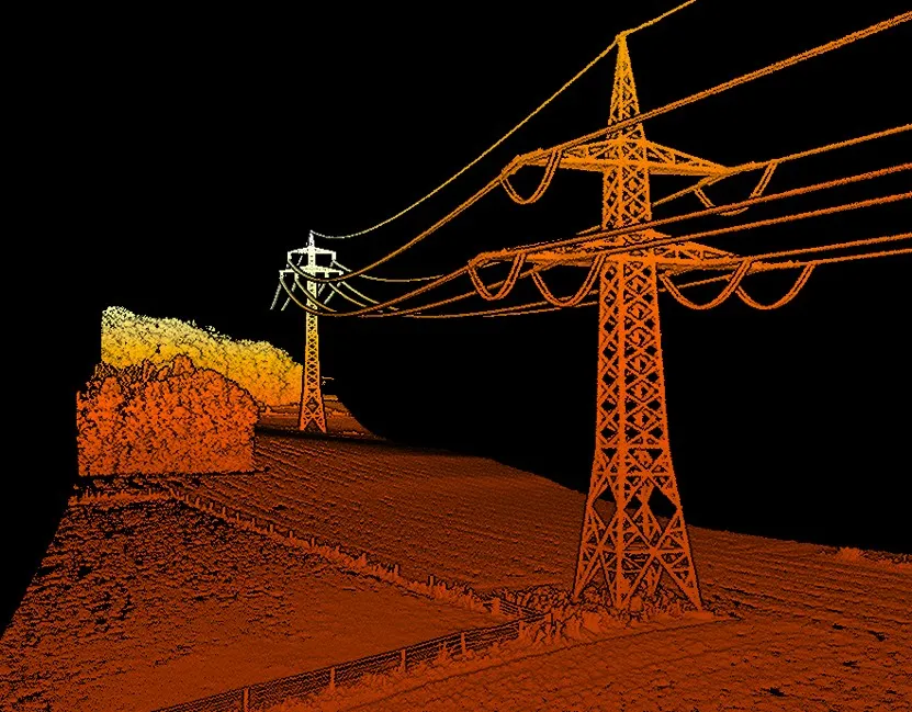
For decades, the limits of a LiDAR system were defined by the environment. Go underground, lose GPS. Enter a dense facility, lose accuracy. Push into a hazardous space, risk the crew. The technology adapted to the terrain — or it didn’t go.
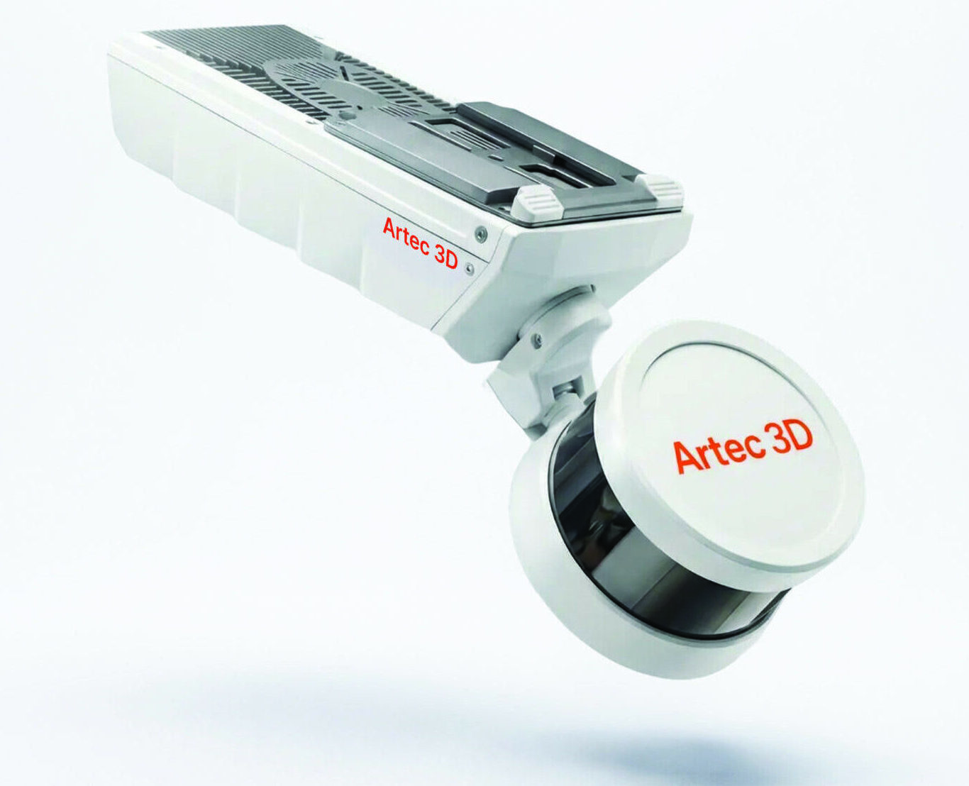
The Artec Jet changes the equation entirely.
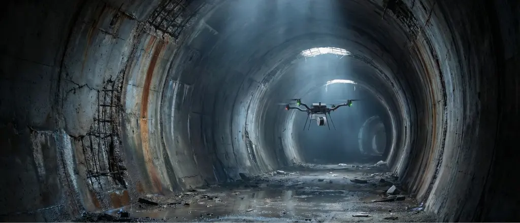
Most mobile LiDAR systems are built around a fundamental assumption: that GPS is available. Above ground, in open terrain, that assumption holds. But the environments where accurate spatial data matters most — underground mines, road tunnels, enclosed industrial facilities, vertical shafts — are exactly the environments where GPS fails.
The traditional workaround? External reference infrastructure. Complex setup. Workflow interruptions. Accuracy trade-offs. Time lost.
This is the gap the Artec Jet was engineered to close.

At the core of the Artec Jet LiDAR system is a SLAM engine — Simultaneous Localisation and Mapping — that replaces GPS dependency with onboard intelligence. Rather than relying on satellite positioning, the device continuously builds and updates an accurate map of its surroundings in real time.
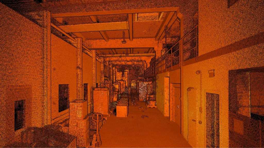
The result: ±10 mm mapping accuracy underground. The same standard professionals expect above it. A ±0.03% drift rate. Up to 1,920,000 points captured per second. A 300-metre sensing range with a 360° × 290° field of view.
These are not marginal improvements. They are the specifications of a LiDAR system designed to perform where others reach their limits.
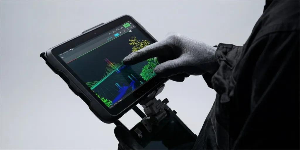
Accurate data collected too late is still a problem. The Artec Jet addresses this directly: every scan streams in real time to a companion app, giving operators a live point cloud preview during capture. Coverage gaps are identified on site. Return visits are eliminated.
Output formats — .las, .laz, .ply, and .e57 — are the industry standards, compatible with the leading survey, BIM, inspection, and digital twin platforms. The data is not only accurate. It’s immediately usable.
The Artec Jet is the large-scale capture solution within the Artec 3D scanning ecosystem — working in combination with the Artec Ray II for structural detail and the Artec Leo for component-level precision. One integrated software environment. Complete digital coverage from entire sites down to individual components.
For professionals whose decisions depend on accurate spatial data, that kind of end-to-end capability is no longer aspirational. It’s available now.
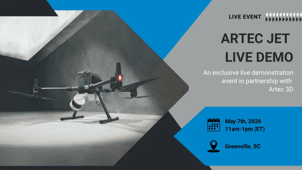
Digitize Designs and Artec 3D are hosting a live demonstration of the Artec Jet in Greenville, SC on May 7th, 2026. See the technology firsthand. Reserve your place.
The Artec Jet represents a significant step forward in mobile LiDAR capability — and understanding how it fits your specific operation is where the real value begins. Whether you’re mapping underground assets, capturing complex infrastructure, or scaling your digital twin workflow, Digitize Designs can help you identify the right solution. Get in touch with our team today to discuss your project requirements.
Long-Range 3D Scanners
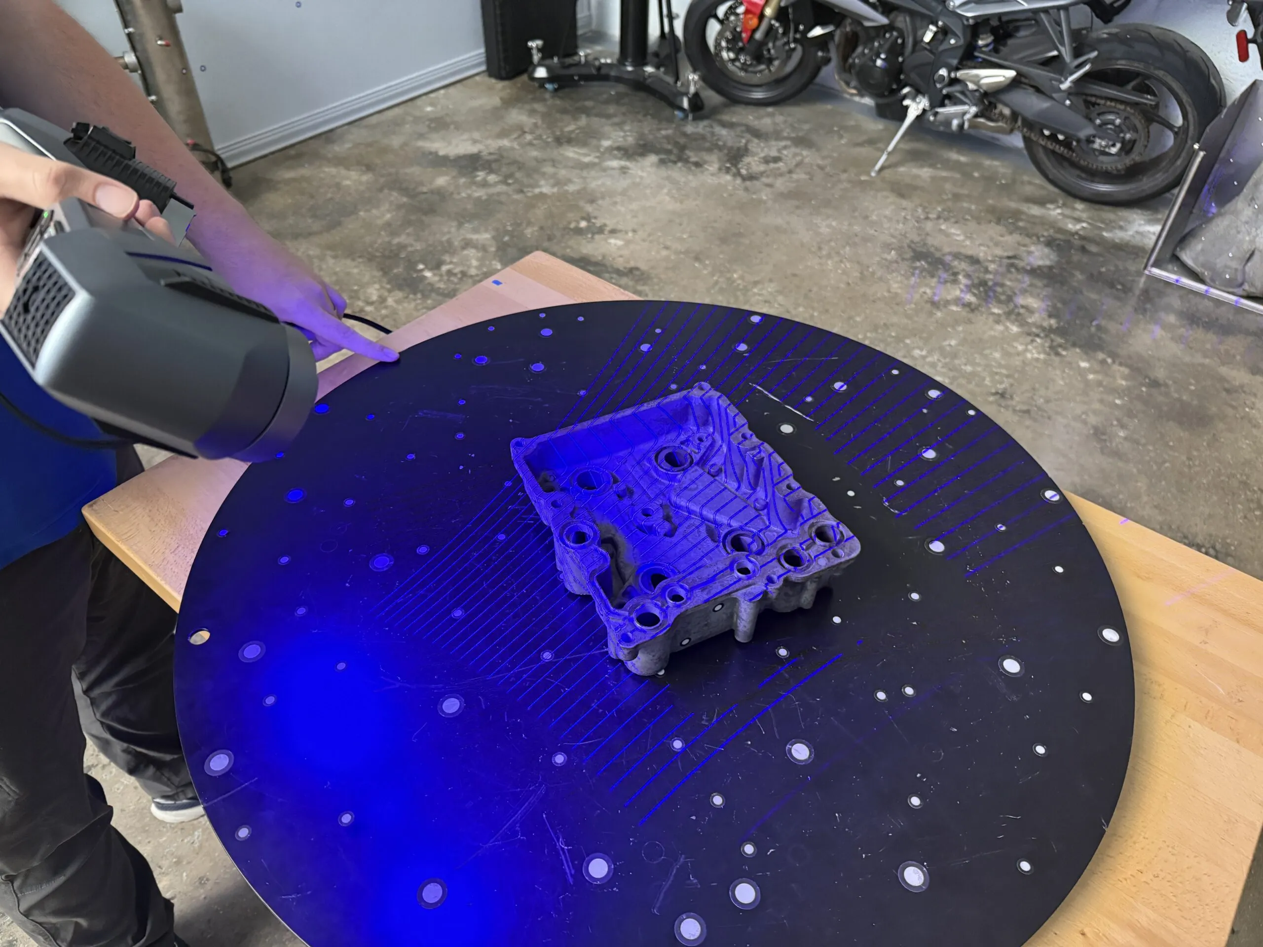
A first article inspection is where a new part program proves it can actually make the drawing. For aerospace and
Every scanner owner eventually meets a part that simply won’t cooperate: a chrome bracket that throws light back at the
Almost every shiny, dark, or translucent part you put in front of an optical scanner refuses to cooperate. Light scatters,
Both are professional-grade Artec LiDAR scanners. Both deliver survey-quality point clouds. But they solve very different problems — here’s how