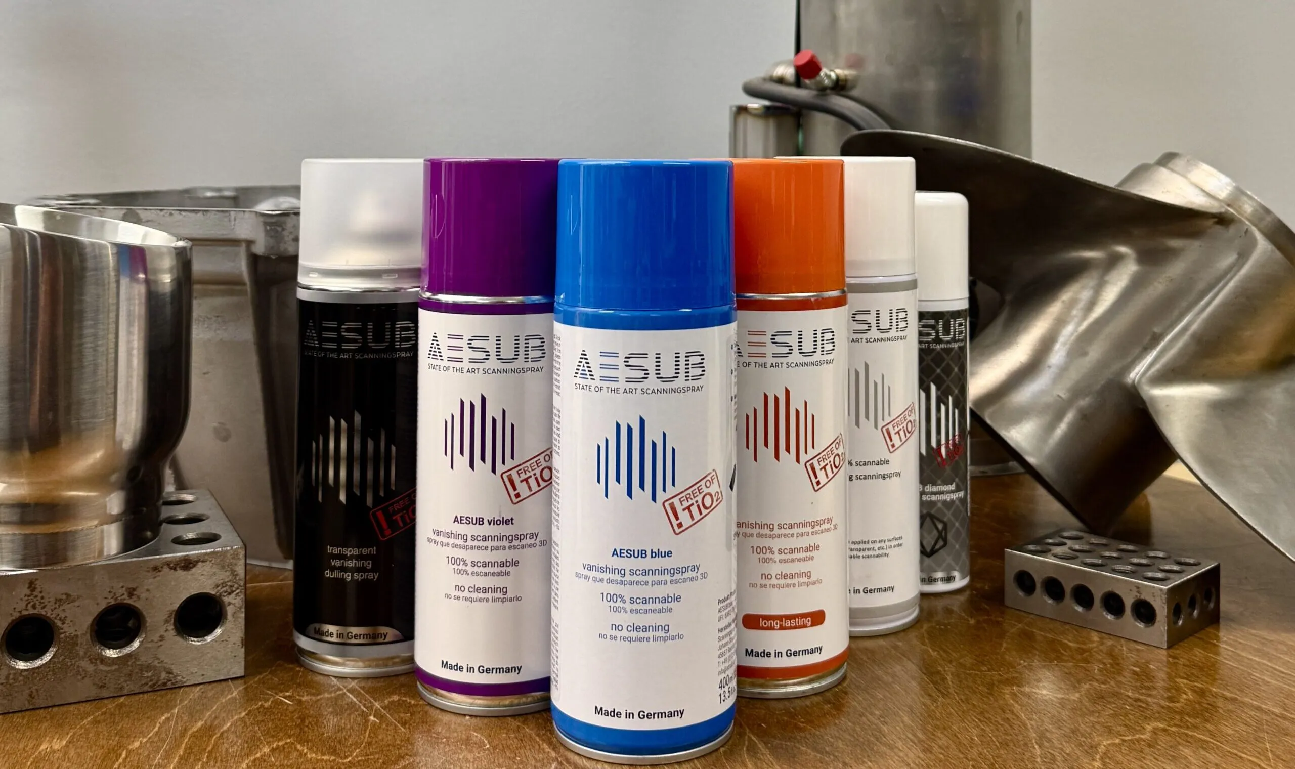
How to Choose the Right 3D Scanning Spray: AESUB and Alternatives Compared
Almost every shiny, dark, or translucent part you put in front of an optical scanner refuses to cooperate. Light scatters,
Both are professional-grade Artec LiDAR scanners. Both deliver survey-quality point clouds. But they solve very different problems — here’s how to choose.
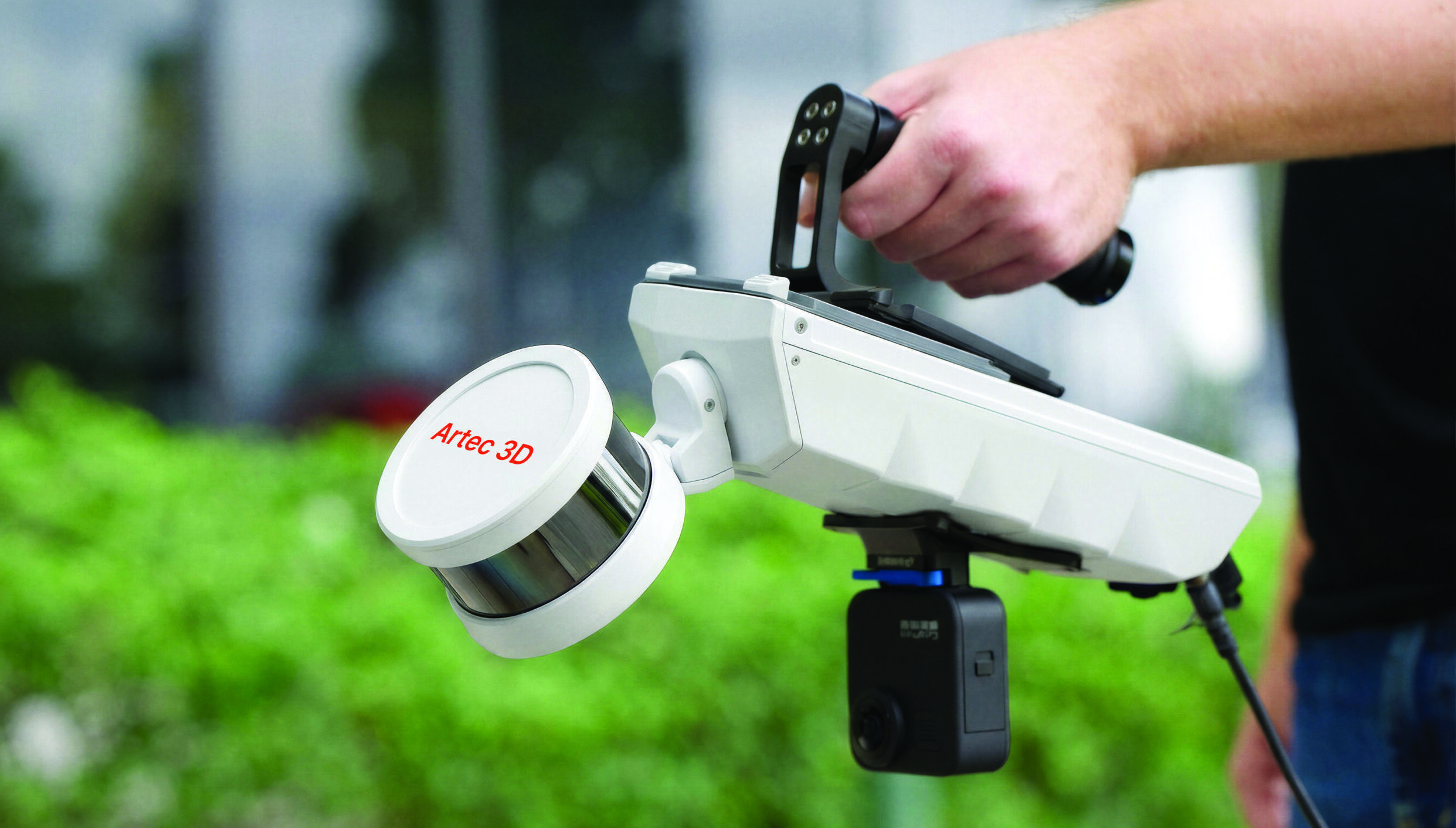
The Artec Jet is a mobile, SLAM-based LiDAR system that deploys across seven different configurations — handheld, drone, vehicle, backpack, robot, telescopic pole, and cage — without requiring GPS or external reference targets. Its 300-meter sensing range and AI-powered autonomous drone mode make it the right tool when the environment is large, dynamic, or physically inaccessible.
The Artec Ray II is a tripod-mounted, stationary laser scanner that delivers some of the highest point accuracy available in a portable long-range device — 1.9 mm at 10 meters. Its 36-megapixel three-camera system and sub-millimeter angular precision make it the right tool when the object is fixed, accessible, and demands uncompromising detail.
In short: the Artec Jet moves with you. The Artec Ray II stays still so everything else can be measured precisely against it.
| Artec Jet | Artec Ray II | |
|---|---|---|
| Specification | Mobile | Stationary |
| Scanning Technology | SLAM-based multi-channel LiDAR | Time-of-flight laser (WFD-enhanced) |
| Sensing Range | Up to 300 m | 0.5 m – 130 m |
| LiDAR Accuracy | ±10 mm (typical indoor) | 1.9 mm @ 10 m / 2.9 mm @ 20 m / 5.3 mm @ 40 m |
| Angular Accuracy | – | 18 arcseconds (0.87 mm @ 10 m) |
| Range Accuracy | ±0.03% drift rate | 1.0 mm + 10 ppm |
| Point Capture Rate | 1,920,000 pts/sec (Multi Return) | 2,000,000 pts/sec |
| Field of View | 360° × 290° (omnidirectional) | 360° × 300° |
| LiDAR Channels | 32 | Single-channel (WFD) |
| GPS Dependency | None (SLAM + optional RTK) | VIS + GNSS + altimeter + compass |
| Color / Texture | Optional RGB camera | 36 MP 3-camera system (432 MPx HDR) |
| Deployment Modes | 7 (handheld, drone, vehicle, backpack, robot, pole, cage) | Tripod-mounted (stationary) |
| Weight | 1.57 kg | 5 kg (with tripod) |
| Power | 64 W (battery or auxiliary) | 8-hour battery (hot-swappable) |
| IP Rating | IP65 | IP54 |
| AI / Autonomy | AI-powered drone waypoints + obstacle avoidance | Auto-calibration + moving object removal |
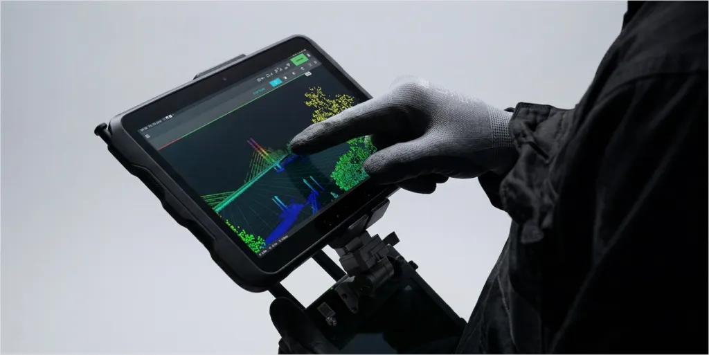
| Software | Artec Studio + real-time companion app | Artec Studio + Artec Remote App |
This is where the two scanners diverge most sharply. For a deeper look at how the Artec Jet’s SLAM engine works in practice, see our full overview: Why the Artec Jet Is Redefining What a LiDAR System Can Do. The Artec Ray II is a precision instrument designed to be set up, leveled, and operated from a single position. Its Visual Inertial System, GNSS integration, and altimeter allow it to track its own position between setups — but each scan session is anchored to a specific location.
The Artec Jet is fundamentally mobile. Its quick-release mounting system allows a user to switch from a handheld walk-through to a drone flight or a robot traverse in seconds, with no recalibration required between modes. This is a significant operational advantage on large or complex sites where a single deployment mode is insufficient.
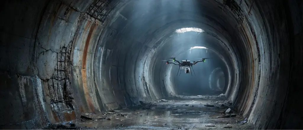
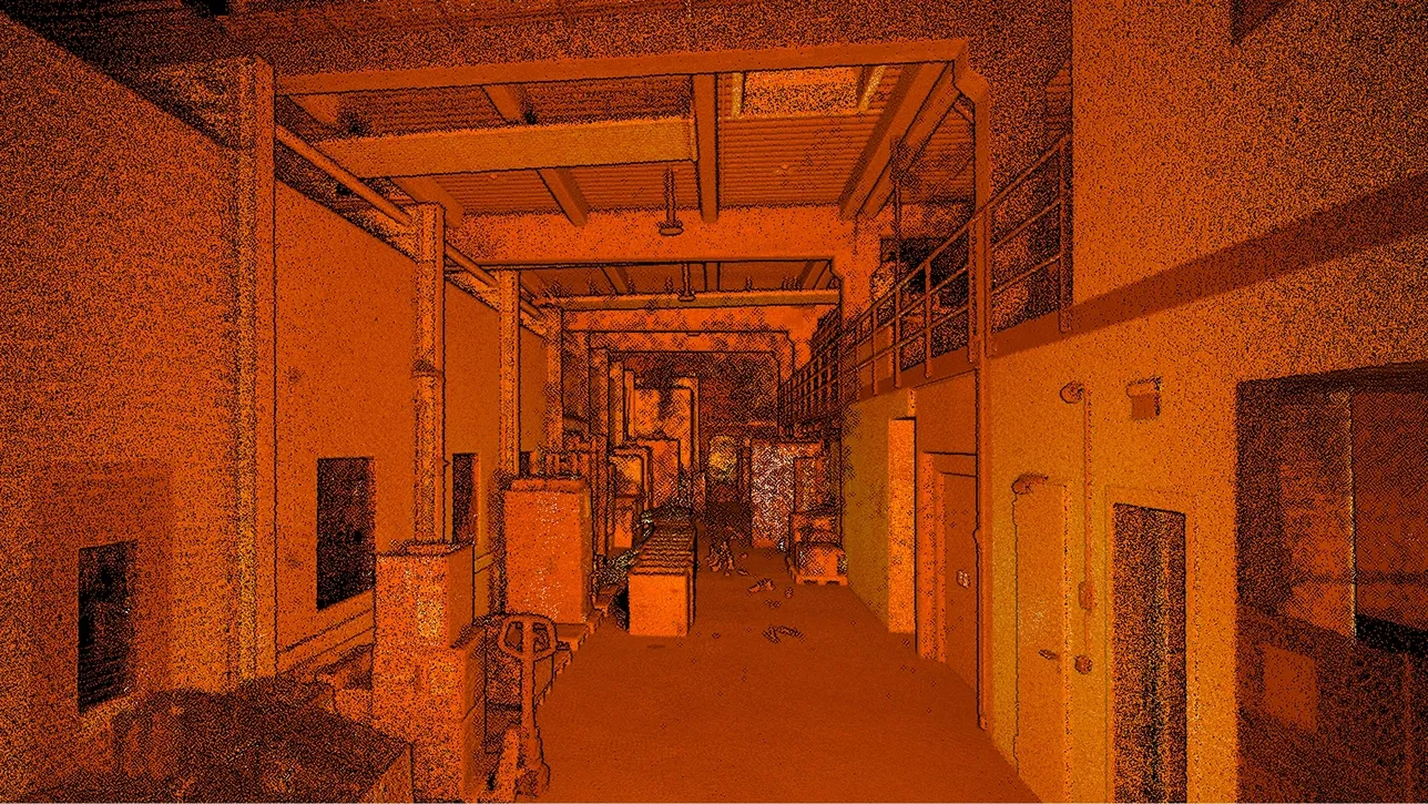
The Artec Jet’s SLAM engine is specifically designed for environments where GPS is unavailable or unreliable — underground mines, enclosed industrial facilities, dense urban canyons. Its ±0.03% drift rate and ±10 mm indoor mapping accuracy make it a viable tool in conditions where the Ray II’s GNSS-dependent positioning provides limited benefit.
The Artec Ray II operates effectively without GPS in short sessions, using its Visual Inertial System to track relative position. However, for extended underground or indoor operations, the Jet’s architecture is the stronger choice.
The Artec Ray II delivers higher absolute point accuracy — 1.9 mm at 10 meters, with angular accuracy of 18 arcseconds. For applications where a component must be measured to engineering tolerances, or where a scan will feed directly into a metrology report, that precision matters.
The Artec Jet’s ±10 mm LiDAR accuracy is survey-grade — appropriate for site mapping, infrastructure documentation, volumetric reporting, and most as-built applications. It is not a replacement for the Ray II in applications requiring metrology-class point data of discrete objects.
The key question is the application: if you need to measure a turbine blade or document a crime scene with forensic precision, the Ray II is the right tool. If you need to map a mine tunnel, survey an urban corridor, or capture a building from a drone, the Jet’s accuracy is entirely sufficient.

The Artec Ray II includes a built-in 36-megapixel three-camera system that captures 432 megapixels of HDR spherical image data per scan position — delivering photorealistic, calibrated color point clouds straight out of the box. This is a significant advantage for heritage documentation, forensics, and any application where visual fidelity is as important as geometric accuracy.
The Artec Jet supports an optional RGB camera add-on that appends true-color attributes to the point cloud, but it is not integrated at the same level as the Ray II’s camera system. For color-critical workflows, the Ray II has a clear edge.
The Artec Jet includes an AI autonomy engine designed for drone deployment. Users can set waypoints and allow the scanner to navigate independently, using omnidirectional LiDAR to detect obstacles as small as 2 mm wire at distances from 1.2 to 40 meters. A return-to-base failsafe ensures safe retrieval if battery levels drop or conditions deteriorate. This enables mapping of environments that operators cannot physically enter.
The Artec Ray II incorporates automatic self-calibration, real-time moving object removal, and remote operation via the Artec Remote App — but it does not include autonomous navigation. It is operated by a human who positions the device, initiates a scan, and reviews the results.
Both scanners integrate with Artec Studio for point cloud registration, processing, and CAD export. Artec Studio supports direct export to SOLIDWORKS and Geomagic Control X for inspection reporting. The ecosystem is consistent across both devices.
Together with the Artec Leo handheld scanner, the Artec Jet and Artec Ray II form a complete end-to-end digitization pipeline: the Jet for site-scale and mobile capture, the Ray II for high-precision fixed-object scanning, and the Leo for close-range handheld detail work. All three share one software platform and one data format.
Yes, and for large, complex projects, many professionals do. A common workflow combines the Artec Jet for rapid site-scale capture (building exterior, infrastructure corridor, underground network) with the Artec Ray II for high-precision documentation of specific components within that site (a mechanical room, a structural joint, a heritage artifact).
Because both scanners process through Artec Studio and share a common data format, the point clouds register cleanly, giving you the coverage of mobile LiDAR and the precision of a stationary laser scanner in a single unified deliverable.
Our certified engineers at Digitize Designs can walk you through a live demo of either scanner — or both. We’ll evaluate your workflow, environment, and accuracy requirements and recommend the right solution.
Long-Range 3D Scanners
Almost every shiny, dark, or translucent part you put in front of an optical scanner refuses to cooperate. Light scatters,
For decades, the limits of a LiDAR system were defined by the environment. Go underground, lose GPS. Enter a dense
When “close enough” becomes a workaround, the real cost isn’t the filler — it’s every decision made on bad data.
Huge infrastructure projects present unique challenges that can only be addressed with advanced solutions like long-range 3D scanners. Whether it’s